


Welcome! If it’s your first time here, you might want to subscribe to my free monthly newsletter. Thank you! —>

Lash and Abah Niesa at Bukit Tabur near KL
‘Abah Niesa’ be-friended me on Facebook. He’s a Malaysian man fond of hiking in Malaysia. When I was preparing to return to Kuala Lumpur recently, we agreed to finally meet and go hiking together. Hiking with locals was one more thing to look forward to in Malasyia!
Soon after my arrival, early one Sunday morning , Abah drove into KL city, picked me up at my friend’s house, and whisked us a slight distance north of the city to hike. He had decided to introduce me to Bukit Tabur, ‘Dragon’s Backbone’, a superbly appropriate hike for Chinese New Year: 2012 is the Year of the Dragon.
I only had a slight idea what to expect on the ‘dragon’ hike. I assumed, with its name, we’d be hiking a ridge trail. In addition, Abah had told me it would take 2-3 hours. He considered ‘Dragon’s Backbone’ one of his easier hikes. Since this was our very first time to meet and to hike together, he didn’t want to thrust me into a major, exhausting all-day mountain climb. As it turned out, ‘Dragon’s Backbone’ was challenging enough!
From central KL, near Petronas Twin Towers, Abah took big highways northeast towards Zoo Negara. In about 20 minutes we reached Desa Melawati, the neighborhood situated at the base of the hike, and took a narrow winding road along the mountain flank to the hike entry point. The area was a basic suburban neighborhood beside the mountain. However, the road was completely lined with parked cars for 100-200 M. They belonged to hordes of people hiking Dragon’s Backbone! Abah explained that this was the only great hike close to the city, and one which offered stunning views. Sounded great to me!
 View of Bukit Tabur near KL |
| View of Dragon’s Backbone- Bukit Tabur- near KL |
The trail ‘head’ was utterly un-marked and un-celebrated. No sign, no marker, nothing to indicate that KL’s most popular and most spectacular hike began there. Just a narrow trail on the edge of the road led up the hillside. If Ahah hadn’t pointed it out to me, I would have been hard-pressed to figure out where to begin! That’s one more advantage of going with a local
 view of valley from Bukit Tabur |
| First viewpoint on Bukit Tabur hike- nearby apartment buildings in the valley |
The trail immediately began climbing steeply up the hillside on a narrow, rock-and-root-infested forest path. It continued climbing uphill for over 20 minutes before it even hinted at leveling off. En route, the first open viewpoint showcased nearby suburban apartment buildings nestled among trees in a bowl-like mountain valley, which was watched over by a lush, vegetation-encrusted rock spire. The next, higher viewpoint revealed a much more spectacular scene: a never-ending sea of lush mountains, surrounding a reservoir lake, the whole decorated with wispy clouds and mist. Rain was hinting that morning, and soon we observed distant Kuala Lumpur darkened by passing rain.

fern forest on Bukit Tabur ridge
Soon the trail climbed onto the ridge line, following a path lined with charming ferns, low stumpy trees, and scattered algae-covered rocks. Despite being on the ridge, however, our climbing was far from over. The ridge line trail continued ascending, intermittently passing through fern or tree forests and clambering over piles of rocks.
Suddenly, the real climbing began: sections of near vertical rock cliffs, which required us to use both hands and careful placement of hands, feet and body. By then we were sharing Dragon’s Backbone with a couple dozen hikers, mostly young Malaysians, both guys and gals. Some westerners were also hiking, testament to the trail’s fame. As we continued ascending the dragon’s rocky spine, views over the mountains and lake spread out further and further into the distance. The scenery was spectacular.
At a particularly extensive, exposed rock outcropping, Abah announced that we’d reached the best viewpoint. We stopped to rest and enjoy the amazing views. The rock-stunned ridge was filled with hikers. Everyone greeted each other with ‘good morning’s, remarked on the gorgeous views and rugged trail, and joked amongst themselves. As I’d experienced many times before, hiking in SE Asia is friendly, cheerful affair.
 view of reservoir from Bukit Tabur |
| Reservoir from Bukit Tabur |
 Abah Niesa enjoying views from Bukit Tabur |
| ‘Abah Nies’a enjoying view from Bukit Tabur |
| Lash at Bukit Tabur |

Lash at Bukit Tabur
Soon the rain which had struck KL was upon us. A light mist sprinkled down as the air chilled significantly. I pulled on my raincoat, grateful I’d been prepared. All along the ridge line, cameras got packed away. We continued on. Little did I know what the dragon had in store for us just ahead…
The trail dipped down into forest. And there we were confronted with a tall rock wall. A rope was dangling from the top of the cliff for any hikers who cared to hang on. Several people were already carefully maneuvering themselves up the cliff face. We lined up for our turn. Luckily for me, I’d already done loads of climbing like this, particularly at my old stomping grounds, Krabi, Thailand, Asia’s most famous rock climbing destination. Dragon’s cliff was not quite a technical rock climb, as it was not literally vertical, and was riddled with plentiful hand and foot holds. One by one, we scrambled up onto the dragon’s hump.
Just over the hump, we came upon a ‘traffic jam’. Dozens of hikers were waiting their turn to inch their way down the hump’s other cliff side. Note: It’s definitely more unsettling to climb down a cliff than up one, particularly if you haven’t climbed up that cliff first. You have to go down backwards, face and body to the rock, peak down below you, and try to locate the next foothold, often without being able to see it. One poor guy that morning, afraid of heights, needed quite a lot of convincing, and a coach who’d done the trail many times, to guide him down that first cliff. Only to discover…

rock climbing at Bukit TAbur
That was just the first of several dragon humps we all had to climb up, over, and down along the Dragon’s Backbone. Each spine presented sheer, nearly vertical walls of rock. Each cliff had a dangling rope. A few also had metal handholds bolted into the rock face. For me, such routes are thrilling. But I had to wonder about novice hikers and city folk who made their way to Dragon’s Backbone. It certainly was not a trail for inexperienced hikers. Indeed, Abah told me that a few people had died and several had been injured attempting to scale the dragon trail. I had no doubts as to why.
After climbing up, over, and down several rock humps, we eventually reached the very last spine bone. We took a well-deserved rest under a forest canopy beside vibrant green moss. We had hiked over 2 hours.
Rest over, we pressed on, this time down the mountainside. The trail lost its rocks and transformed into a typical forest path through leafy green tropical trees. In the upper reaches we came upon spectacular views of distant KL surrounded by lush mountains. Lower down, we marched through pleasant, shady forest all the way back to the parking area. The downhill return took only 45 minutes, bringing our total hiking time to nearly 3 hours, just as Abah had predicted.
I thanked him profusely for taking me on such a superb hiking trail. We had marveled at spectacular views of lake and mountains on one side with equally stunning views of distant city on the other. We had sustained a serious work out. And we had enjoyed a varied loop trail through forest, fern fields, rock outcrops and challenging rock climbs. It couldn’t have been better.
 Kuala Lumpur view from Bukit Tabur |
| Stunning views of Kuala Lumpur on the return trail, Bukit Tabur ‘Dragon’s Backbone’ |
I was only left wondering what Abah’s harder hikes were like! Hopefully, I’ll find out soon. And, in fact, I’ve been invited to climb Lombok Indonesia’s famous Mt. Rinjani in July, with Abah and his group of climbers. Hope I can make it!
If you enjoy hiking, nature and adventures, next time you’re in Kuala Lumpur, I highly recommend trekking Buikt Tabur, Dragon’s Backbone. And Abah has kindly offered to assist you, if you’d like!
Below is practical information on accessing, preparing, and hiking at Bukit Tabur.
———————————————————————————————————————————————
Meanwhile, you might also like:

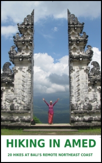
Guidebook to Hiking in Bali – by Lash
10 Free Things to do in Kuala Lumpur
Photo Gallery: Colorful Kuala Lumpur
my Guidebook to Hiking in Bali
my Guidebook to Cycling Bali
————————————————————————————————————————————————
Logistics for hiking Dragon’s Backbone:
Location:
Bukit Tapor is located about 20 km northeast of central KL in an area called Taman Desa Melawati, and near Zoo Negara. It’s about 20-30 minutes’ drive from the city.
Facilities:
None. There’s no bathroom, food, or shelter at the trail head. However, 5-minutes’ drive below the trail head there are several ‘warungs’- local eating shops- serving Indian and Malay food and drinks. They also have toilets. Stop to eat before and/or after your hike.
Take with you:
Plenty of water, preferably some electrolyte drink such as Gatorade or 100Plus, raincoat, warm pants just in case, sturdy shoes, bandana to wipe sweat, camera, snack or food if desired, smiles. *remember, ANY mountain’s weather can change suddenly and drastically. It’s always wise to carry rain gear, warm clothes and some energy food, just in case.
Access:
This is one difficulty for tourists wanting to hike Dragon’s Backbone. There’s no public transportation going there. You need private transportation. Otherwise, take a taxi. From central KL, I’m told it will cost 10-15 MR ($3.50 – $5 US) To get back, you could either ask the taxi to wait for you or else catch a ride with other hikers donw to the local food shops, where you’ll be able to get a taxi.
Abah Niese FB has invited you to connect with him on FB. You can ask him for more information and, perhaps if he’s available, he will take you there himself! Thanks Abah!
————————————————————————————————————————————————————

 Hi! I'm Lash, an American nomadic world traveler who's been traveling solo since 1998. I’m passionate about traveling the world nomadically and then sharing it all with you. I hope to inspire you to travel the world, to entertain you with tales from the road, and to help you reach your travel dreams. Welcome!


9 pings
Skip to comment form ↓
THAIPUSAM FESTIVAL EXPLAINED - LashWorldTour » LashWorldTour
2012/02/29 at 2:55 am (UTC 8) Link to this comment
[…] might also like:Photo Gallery: Thaipusam in Penang 201210 Free Things to do in Kuala LumpurHiking ‘Dragon’s Backbone’ on Chinese New Year .nrelate_popular .nr_sponsored{ left:0px !important; } /* Leave a Reply Cancel […]
10 Free Things to do in Kuala Lumpur- pt 2- 10 MORE - LashWorldTour » LashWorldTour
2012/02/29 at 2:55 am (UTC 8) Link to this comment
[…] KTMB Headquarters. (Train company).You might also like:10 Free Things to do in Kuala Lumpur, pt. 1Hiking Dragon’s Backbone on Chinese New YearPhoto Gallery: Colorful Kuala LumpurPhoto Gallery: Diverse Kuala LumpurPhoto Gallery: Penang […]
TRAVEL TIP: SECRET EATING SPOTS IN KUALA LUMPUR - LashWorldTour » LashWorldTour
2012/02/29 at 2:55 am (UTC 8) Link to this comment
[…] might also like:10 Free Things to do in Kuala Lumpur10 MORE Free Things to do in Kuala LumpurHiking ‘Dragon’s Backbone’ on Chinese New YearPhoto Gallery: Colorful Kuala LumpurPhoto Gallery: Diverse Kuala Lumpur.nrelate_popular […]
REVIEW: KUALA LUMPUR BIRD PARK - LashWorldTour
2012/04/24 at 2:45 am (UTC 8) Link to this comment
[…] might also like:Photo Gallery: Brilliant Birds of The WorldPhoto Gallery: Water Birds of FloridaHiking ‘Dragon’s BAckbone’ on Chinese New Year10 MORE Free Things to do in Kuala Lumpur* note- although Taman Burung sponsored my visit to the […]
Choosing the Correct Socks for Travel » LashWorldTour
2014/02/14 at 9:16 am (UTC 8) Link to this comment
[…] Hiking Dragon’s Backbone in Malaysia […]